Technology
Our Technology
Three layers work together: commercial drones capture the data, multi-sensor payloads see what the eye cannot, and AI algorithms turn raw imagery into actionable building intelligence.
50MP
Visual Resolution
20+
Defect Types Detected
GPS
Referenced Mapping
24hr
Report Delivery
Hardware
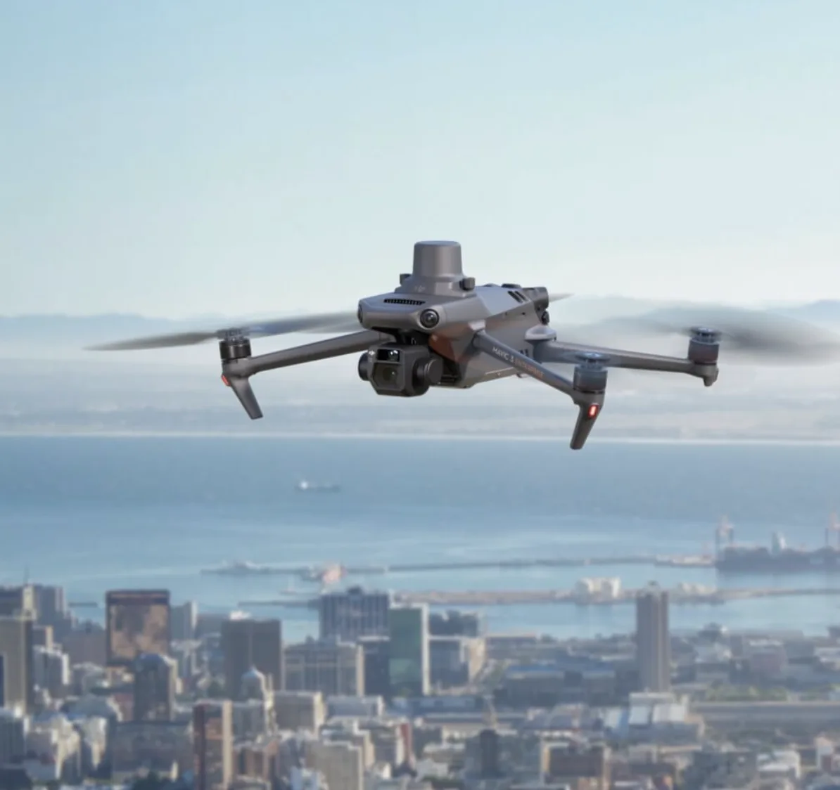
Commercial-Grade Drone Fleet
Our inspection fleet consists of commercial-grade quadcopter and multi-rotor drones purpose-built for building envelope inspection. Each aircraft is maintained to strict schedules and equipped with redundant safety systems including dual GPS, obstacle avoidance, and automated return-to-home.
Multi-rotor platforms optimized for close-proximity facade scanning
Dual GPS and obstacle avoidance for safe building-proximity operations
Interchangeable payload mounts for visual, thermal, and LiDAR sensors
Extended flight time for complete building coverage in a single session
Wind-resistant airframes rated for coastal conditions
Automated return-to-home and geofencing safety protocols
Flight Capabilities
Building Height
3 to 50+ stories
Flight Duration
4-8 hours per building
Coverage
90-100% facade
Airspace
All FAA classes (LAANC)
Safety Systems
Pre-flight risk assessment and site survey for every job
Real-time telemetry monitoring during all operations
Visual observers on site for controlled airspace flights
Emergency landing protocols and backup battery systems
Software
AI Defect Detection Platform
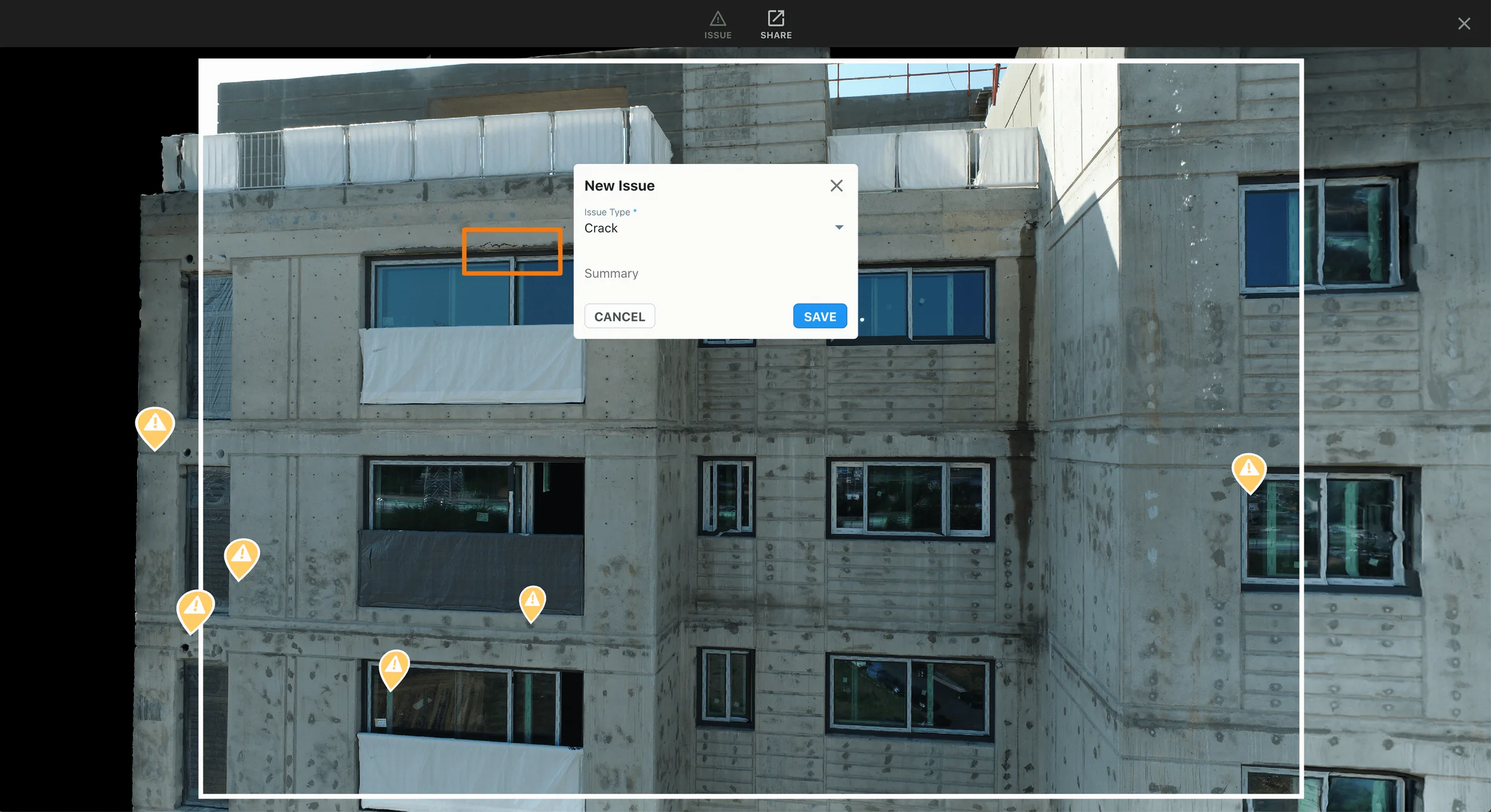
Our machine learning platform processes thousands of inspection images per building, automatically detecting and classifying defects that would take human reviewers days or weeks to identify. The AI does not replace engineering judgment -- it augments it with comprehensive, consistent, and repeatable analysis.
Detection
Identifies anomalies across every captured image using trained neural networks
Classification
Categorizes each defect by type (crack, spalling, corrosion, etc.) and assigns severity scores
Measurement
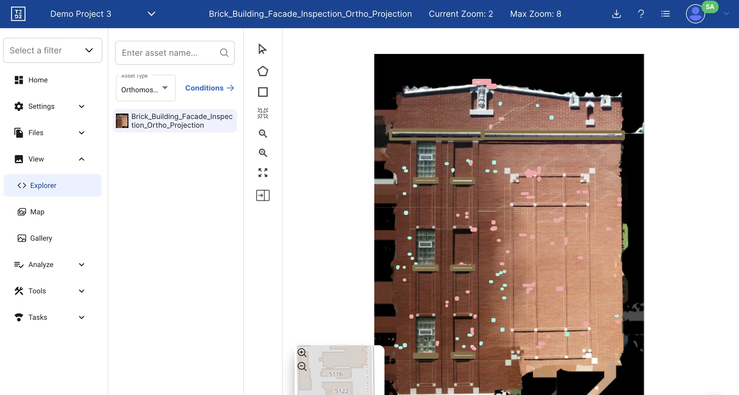
Calculates defect area in square footage using photogrammetric reference data
Geolocation
Maps every defect to GPS coordinates on the building facade for precise field reference
Detectable Defect Types
Cracks
Hairline Cracks
Spalling
Delamination
Corrosion
Rust Staining
Efflorescence
Sealant Failure
Water Intrusion
Staining
Surface Erosion
Joint Separation
Paint Failure
Mold/Mildew
Window Seal Failure
Flashing Defects
Concrete Deterioration
Mortar Loss
Structural Movement
Thermal Anomalies
Sensors
Multi-Sensor Data Capture
Each inspection combines multiple sensor types for comprehensive building analysis. Visual cameras see surface defects. Thermal sensors reveal hidden problems. Together, they provide a complete picture.
RGB Visual Camera
High-resolution visual cameras capture surface-level defects with exceptional detail. Up to 50 megapixels of resolution allows identification of hairline cracks and subtle surface changes.
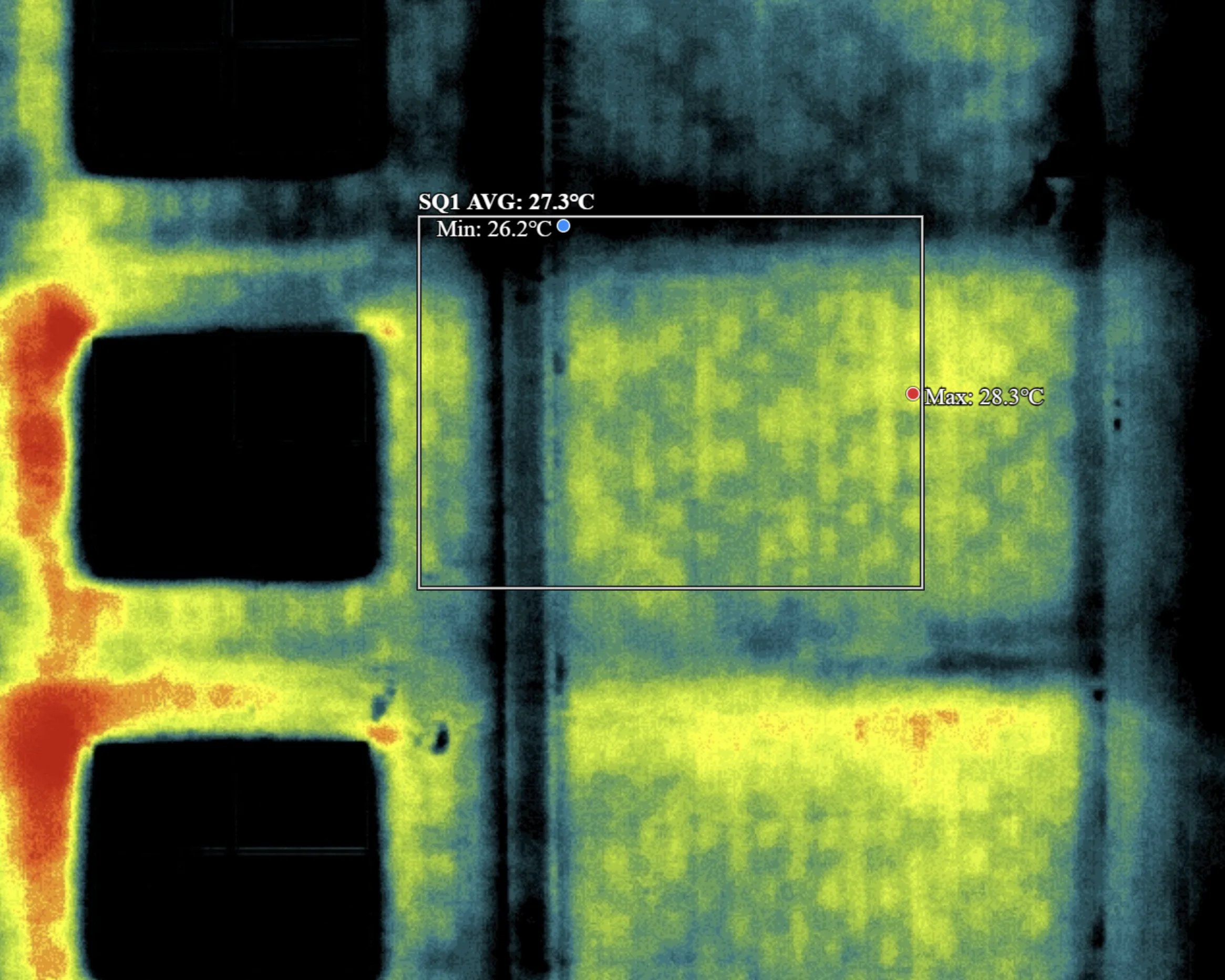
FLIR Thermal Sensor
Forward-looking infrared sensors detect temperature differentials that indicate moisture intrusion, insulation failure, structural separation, and hidden defects invisible to the naked eye.
3D Mapping & LiDAR
Photogrammetry and LiDAR-capable payloads generate precise 3D models and point clouds of building facades. 1-inch accuracy enables remote measurement and digital twin creation for engineering teams.
Output
Reports and Deliverables
Every inspection produces a comprehensive deliverable package. The PE-certified report is the centerpiece, but you also receive all supporting data for integration with your maintenance, engineering, or capital planning workflows.
PE-certified inspection report (PDF) meeting SB-4D requirements
Annotated high-resolution imagery with defect markers
GPS-referenced defect maps plotted on building elevations
Thermal overlay analysis for hidden anomalies
Printable orthomosaics for contractor scope-of-work
Excel/CSV defect data export for management systems
3D models and point clouds (when 3D mapping is included)
Repair priority recommendations with cost estimates
Report Formats
PDF Report
PE-certified, print-ready
Excel / CSV
Defect data for analysis
Orthomosaic Maps
Scaled facade elevations
Thermal Overlays
IR heat maps with analysis
3D Model / Point Cloud
Digital twin with measurements
Turnaround: All standard deliverables are included with every inspection and delivered promptly after flight completion. No additional charges for standard report formats.
See This Technology Applied to Your Building
Every building is different. Contact us for a free consultation to discuss which sensors and analysis methods are right for your property.
Safety & Compliance
Regulatory Adherence at Every Step
We operate under FAA Part 107 regulations with additional safety protocols for building-proximity drone operations. Every flight is planned, authorized, and monitored.
FAA Part 107
Certified remote pilots. LAANC authorizations for controlled airspace. Full regulatory compliance.
PE Certification
Florida-licensed Professional Engineer review and certification on all inspection reports.
$5M Insured
General liability coverage per occurrence. Additional insured certificates available upon request.
SB-4D Compliant
Reports meet all Florida SB-4D milestone structural inspection and SIRS requirements.
See the Technology in Action
Free consultation. We will explain exactly how our technology addresses your building's inspection needs.
Before You Go
Get Your Free Inspection Quote
Takes 30 seconds. 1-hour average response time, 24/7.